Weakened La Niña forecast for late 2024, impacting global weather
Weakened La Niña forecast for late 2024, impacting global weather | Insurance Business Australia
Insurance News
Weakened La Niña forecast for late 2024, impacting global weather
What will the weather patterns in Australia be like for the remainder of 2024?
Insurance News
By
Jonalyn Cueto
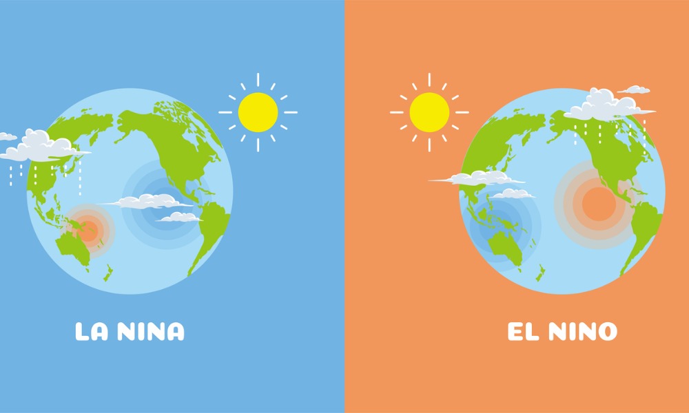
After months of speculation, the much-anticipated La Niña weather pattern is expected to develop later than initially predicted and in a milder form, according to the US Climate Prediction Center.
A Bloomberg report noted that there is now an 83% chance the weather phenomenon, which typically cools the Pacific Ocean, will emerge between November and January. However, its delayed arrival means that other climate drivers will likely have a greater influence on global weather patterns.
La Niña, often associated with drought conditions in places like California and Brazil and heavier rainfall in regions such as Indonesia and Australia, was expected to have arrived during the summer. However, climate models proved overly optimistic, as noted by forecaster Michelle L’Heureux, who explained, “Clearly the forecast models were a little too bullish on this event.”
The delayed onset means La Niña will have a weaker atmospheric effect, allowing other weather patterns, such as the North Atlantic Oscillation, to have more sway. This pattern could play a critical role in shaping winter conditions in the US Northeast, where it might determine whether the region experiences a mild or severe winter.
Australia braces for extreme weather
Meanwhile, Australia is preparing for more extreme weather events despite neutral Pacific and Indian Ocean conditions currently prevailing. Andrew King, a senior lecturer in climate science at the University of Melbourne, highlighted in a report on The Conversation that the seasonal outlook is more uncertain and less predictable without a strong climate driver like La Niña or El Niño.
While parts of eastern Australia are expected to experience wetter-than-average conditions, boosting the risk of river flooding, areas such as western and central Victoria face continued drought conditions. Additionally, Australia is likely to endure a warmer-than-average spring, continuing the trend of high temperatures seen during the country’s warmest August on record.
The forecast also points to heightened risks of bushfires, particularly in northeastern Australia and drought-stricken regions. Marine heatwaves are another growing concern, especially in the Tasman Sea, due to the elevated sea surface temperatures. However, it remains too early to predict tropical cyclone activity for the upcoming summer.
Have you noticed any unusual weather patterns in your area recently? Share your stories below.
Related Stories
Keep up with the latest news and events
Join our mailing list, it’s free!