B.C.’s plan for flood mapping and building back better

A new report by the Government of British Columbia details its commitment to developing a provincially coordinated floodplain mapping program, and sheds light on how and where it intends to rebuild communities after a flood.
More specifically, the report, From Flood Risk to Resilience: A BC Flood Strategy to 2035, breaks down the steps the government plans to take to: a) establish and coordinate a multi-year floodplain mapping program; b) build back better pre- and post-disaster; and c) move people and buildings from flood-prone areas.
The report details four pathways the province will take to enhance flood resilience in the short- and long-term, as follows:
Understanding Flood Risk
Strengthening Flood Risk Governance
Enhancing Flood Preparedness, Response and Recovery
Investing for Flood Resilience
Flood maps
In its efforts to understand flood risk, the government announced its intention to develop a floodplain mapping program.
The program will “develop modernized, provincial floodplain mapping guidance for local governments, First Nations, and qualified professionals on the use of floodplain maps to support flood preparedness, mitigation, and adaptation efforts,” the report reads.
Once released, the maps will be updated within 10-year intervals with priority to areas experiencing rapidly shifting flood hazards and will be used for infrastructure planning in the province.
The province also plans to conduct a province-wide flood risk assessment to establish its key flood risks. Among these steps, B.C. will explore potential threats of storm surge flooding, which is increasing in frequency and intensity when combined with sea level rise.
“With over 200,000 B.C. households at high risk of flood damage – the third-highest risk in Canada – this strategy is an important step in better protecting families, businesses and communities moving forward,” Aaron Sutherland, Insurance Bureau of Canada’s pacific and western vice-president, says of the province’s plan.
Post-event rebuilds
The B.C. government also detailed its plan for enhancing flood preparedness, response and recovery. Part of that includes rebuilding communities with better flood protections.
“To support and enhance post-emergency flood recovery planning, the province will assist communities in rebuilding in a resilient, culturally safe, and appropriate manner post-disaster. This approach aims to facilitate recovery from economic, social, and cultural disruption, among additional efforts,” the report reads.
Within this context, the government intends to explore how best to improve building guidelines to support flood resilience. There may also be incentives for homeowners, farmers, and businesses in high-risk areas to flood-proof their buildings.
Of particular interest for the P&C industry, which has long debated the merit of rebuilding in floodplains, the government also details its strategy for community-led, managed retreat investments. Or, essentially, moving people from their flood-prone communities, the government says.
“Community-led managed retreat involves moving people, buildings and infrastructure from hazard-prone areas to reduce future risks,” the report reads.
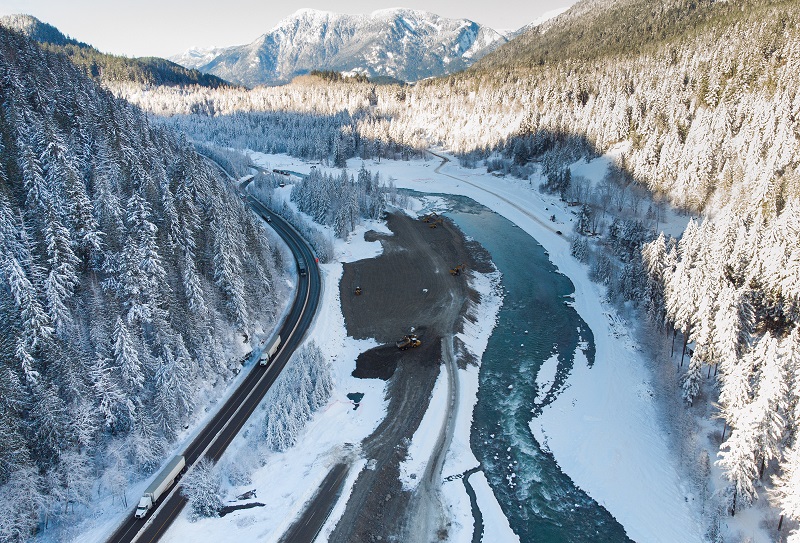
Transport trucks hauling trailers travel on the Coquihalla Highway after it was reopened to commercial traffic as heavy equipment is used to rebuild the southbound lanes that were washed away by flooding last month at Othello, northeast of Hope, B.C., on Monday, December 20, 2021. THE CANADIAN PRESS/Darryl Dyck


